

Weather Alert Center
Weather Alert Center is brought to you by Insurance Incorporated.

How to Receive Emergency Alerts
To get immediate notifications about road closures and weather warnings, use the following resources:
Power Outage Information:
Cleveland Utilities Outage Map Outage.clevelandutilities.com
Volunteer Energy Outage Map Volunteer.outagemap.coop/
Local News & Continuous Coverage
For ongoing weather analysis and hyper-local updates throughout the storm:
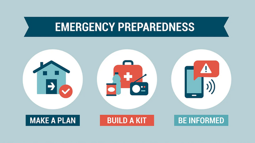
Preparation Essentials
Experts warn that ice can be more damaging than snow, often leading to prolonged power outages. Officials recommend you stock up now to avoid travel during the storm:
To get immediate notifications about road closures and weather warnings, use the following resources:
- Cleveland & Bradley County: Text “JOIN CBCOEM” to 31002 to sign up for local alerts from the Office of Emergency Management.
- McMinn County (Athens): Sign up via the Emergency Services website at www.mcminncounty.tn.gov/ems.
- Meigs County: Monitor the Meigs County Sheriff’s Office Facebook page for all official area alerts. https://www.facebook.com/MeigsCountySheriffsOffice
- Polk County: Register for emergency notifications at polkcountytn911.com.
- Rhea County: Sign up for the county alert system at rheacounty.tn.org/emergency.
Power Outage Information:
Cleveland Utilities Outage Map Outage.clevelandutilities.com
Volunteer Energy Outage Map Volunteer.outagemap.coop/
Local News & Continuous Coverage
For ongoing weather analysis and hyper-local updates throughout the storm:
- Radio: Stay tuned to WCLE for the latest forecasts and information specifically for the Cleveland area. https://mymix1041.com/weather-alert-center
- Television: Follow our news partners at Local 3 for updated snow and ice totals. https://www.local3news.com/local-weather/
Preparation Essentials
Experts warn that ice can be more damaging than snow, often leading to prolonged power outages. Officials recommend you stock up now to avoid travel during the storm:
- Food & Meds: Have enough non-perishables and prescription medications to last through next Wednesday.
- Supplies: Ensure you have plenty of water, batteries, flashlights, and a first-aid kit.
- Home Safety: Prepare for freezing temperatures by protecting pipes and securing a backup heat source if possible.

